X-Plane plugin
Native in-cockpit rendering inside the sim.


Simulation only
A high-fidelity reimplementation of the G1000 NXi integrated flight deck for X-Plane — Primary Flight Display, Multi-Function Display, and the NXi page groups pilots use every day.
Detecting your OS…
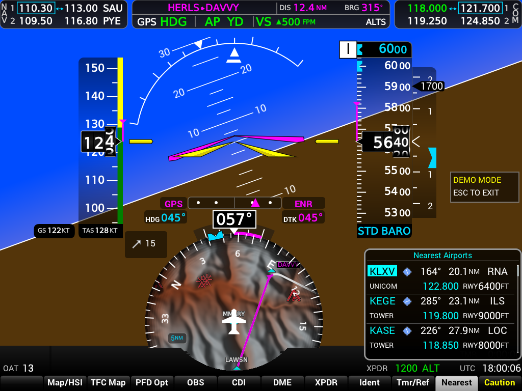
Native in-cockpit rendering inside the sim.
External PFD/MFD windows over UDP — multi-monitor ready.
Layout and behavior from public documentation — no copied bitmaps.
Work in progress — features are being completed iteratively.
Attitude, airspeed, altitude, HSI, radios, inset maps, and NXi-style annunciations.
Full tape displays, trend vectors, wind, bearing pointers, and the HSI Map layout with terrain shading.
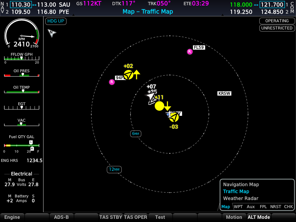
ADS-B traffic on the PFD with range rings and traffic symbols matched to NXi symbology.
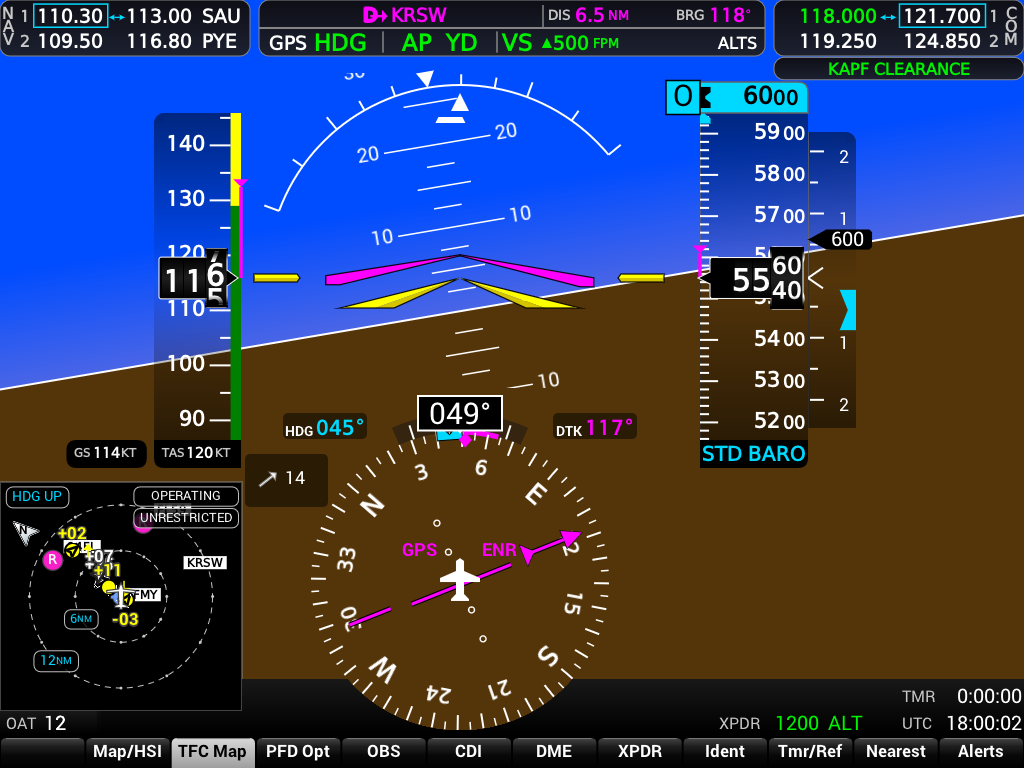
Pop-up Nearest Airports list on the PFD with identifiers, bearing, and distance.
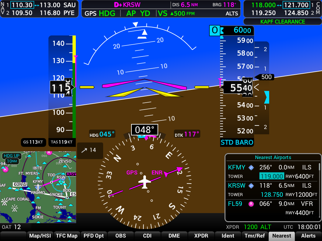
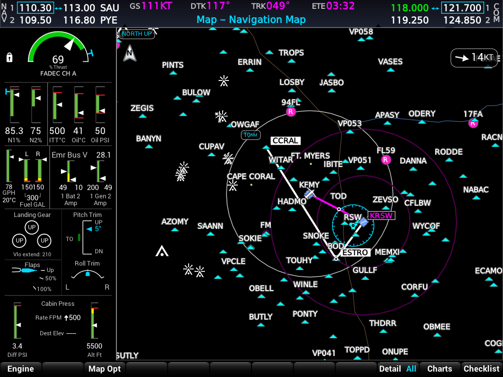
Navigation map, engine strip, and every major NXi MFD page group.
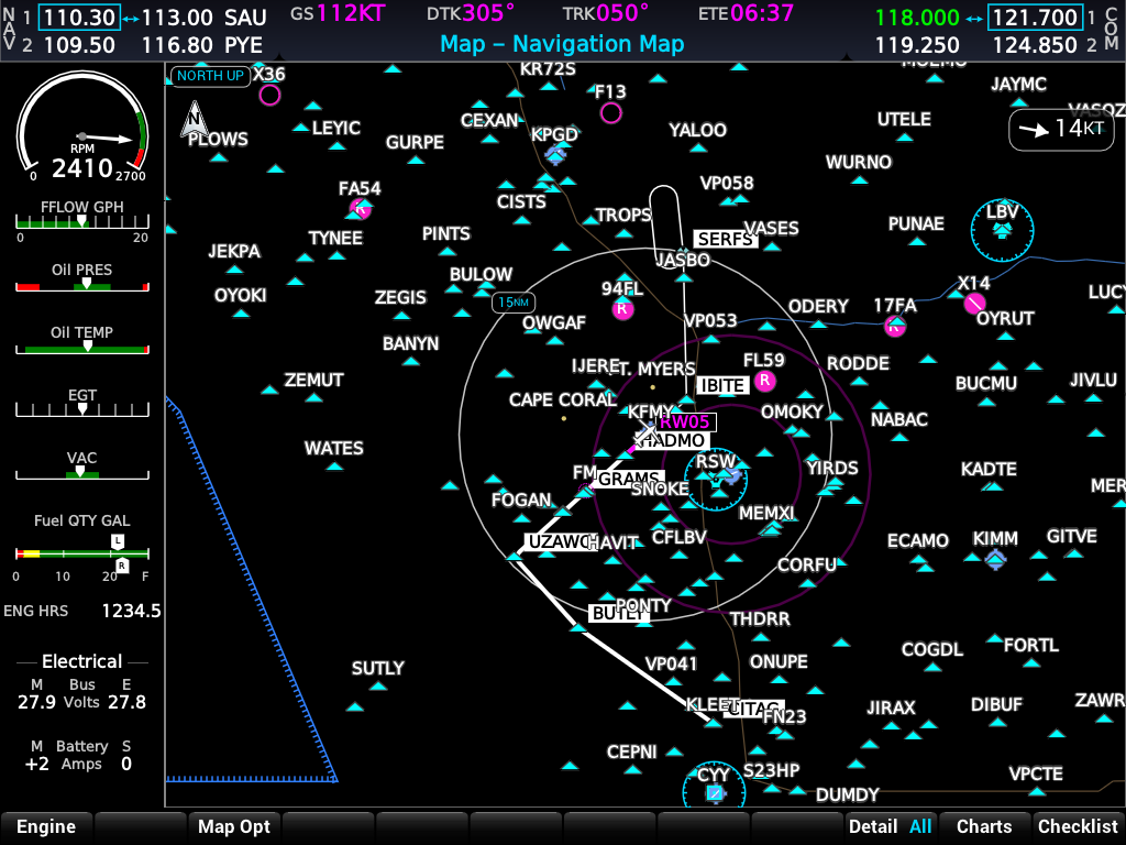
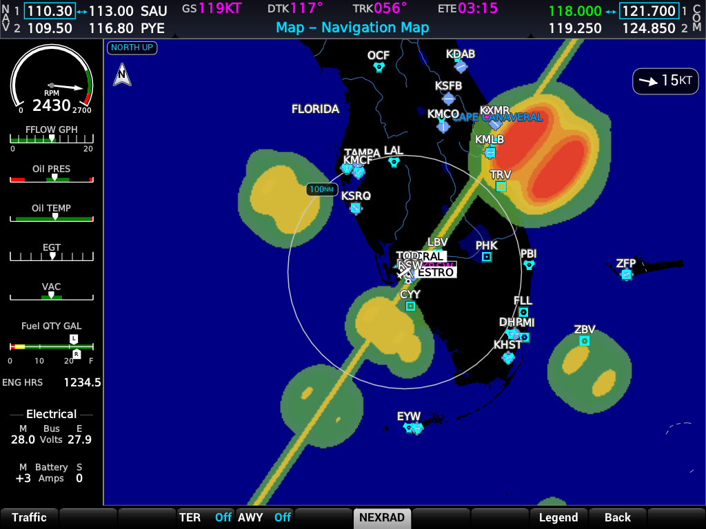
Moving map with terrain, airways, flight plan overlay, and map setup options.
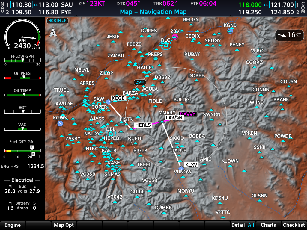
Per-aircraft EIS strip on every MFD page — gauges and electrical readouts from a plain-text .eis file. Bundled profiles include the Cirrus Vision Jet SF50 and Cessna 172.
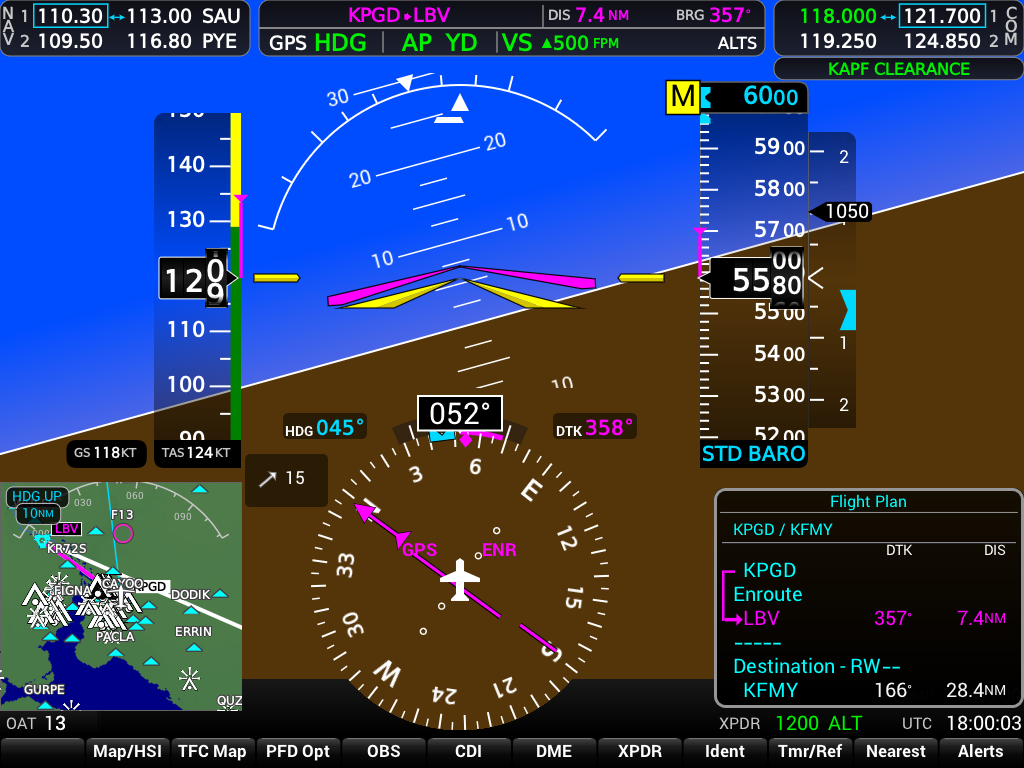
Build, edit, and activate routes on the PFD and MFD — with live sync to X-Plane's FMS.
FPL page on PFD and MFD with leg editing, airway insertion, and enroute course lines on the map.
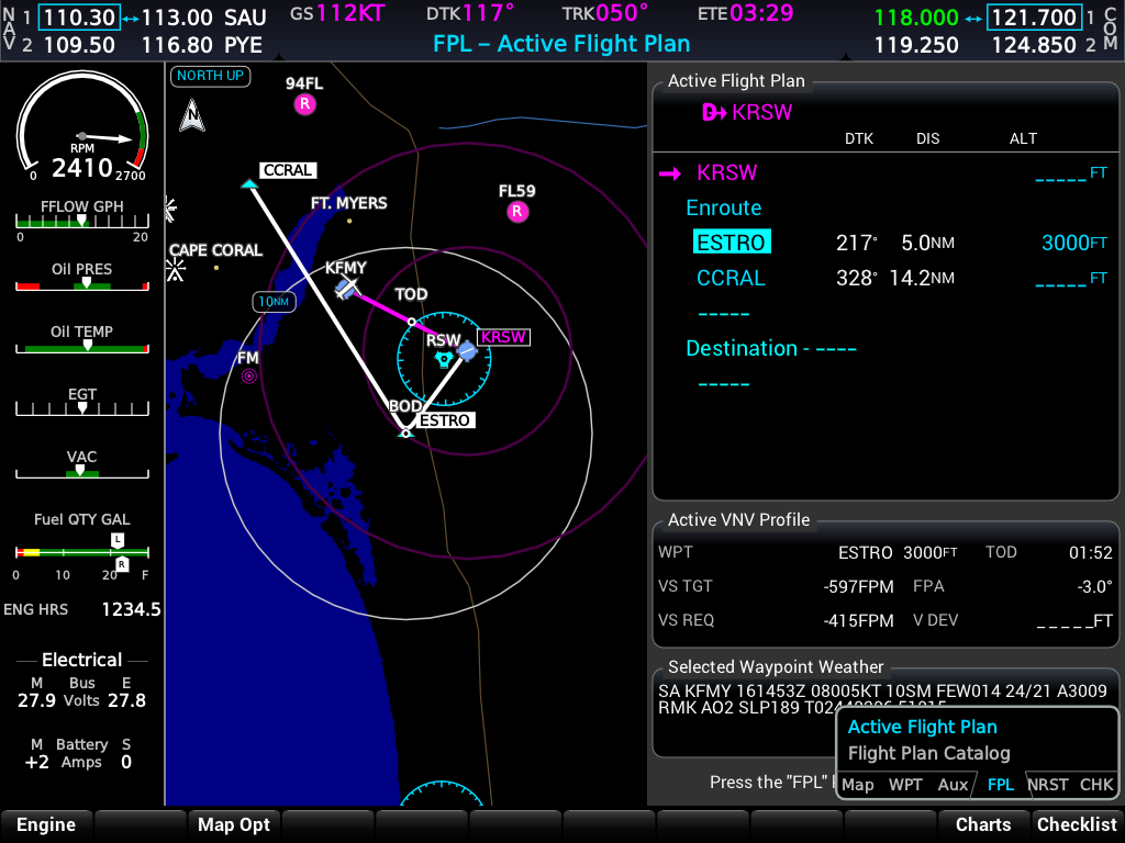
Enroute editing on the MFD with map-linked course preview, VNAV altitude constraints, and flight-plan weather data.
Plan descents from designated altitude constraints — the FMS builds a 3° flight-path angle profile to each target, with guidance on the PFD and map.
Designate an altitude on the FPL page (cyan VNAV ALT column) or press ENT on a published restriction. The Active VNV Profile box shows the target waypoint, descent rate, flight-path angle, and time to top of descent.
Within one minute of the top of descent, the PFD shows a magenta vertical-deviation pointer, target altitude above the altimeter tape, and required vertical speed on the VSI.
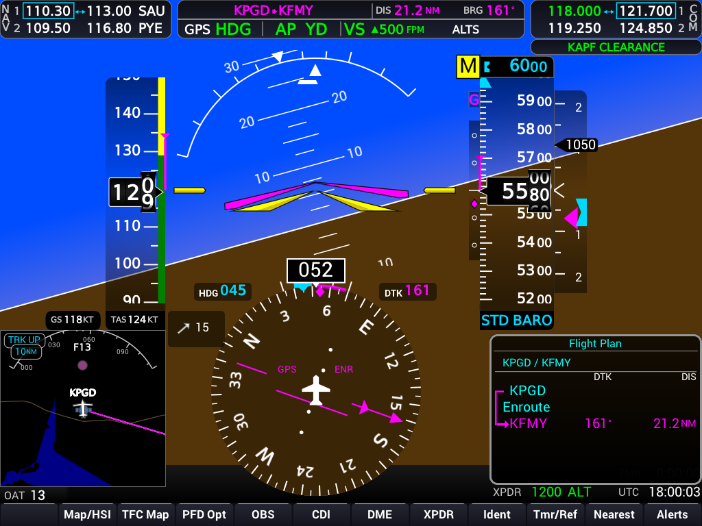
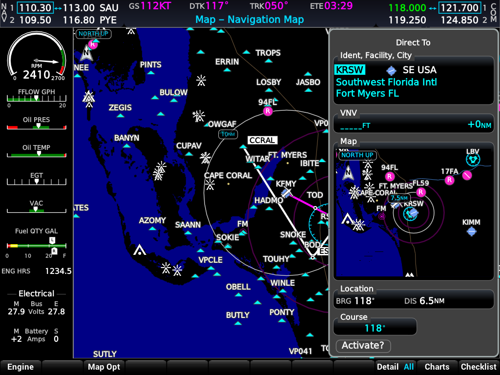
Activate Direct-To to any waypoint, airport, or lat/lon — with map inset and FMS write-back.
Ident entry, waypoint type selection, and course preview before activation.
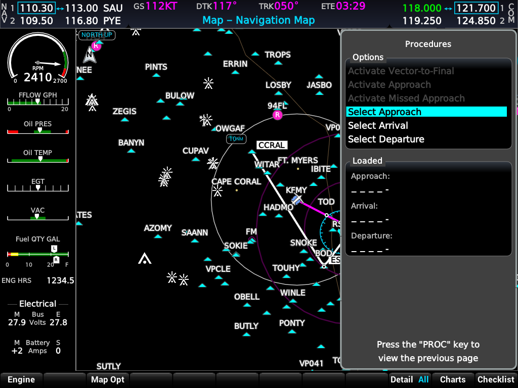
Departure, arrival, and approach procedure selection from CIFP nav data.
Choose SIDs, STARs, and approaches from the MFD Procedures menu with NXi-style options.
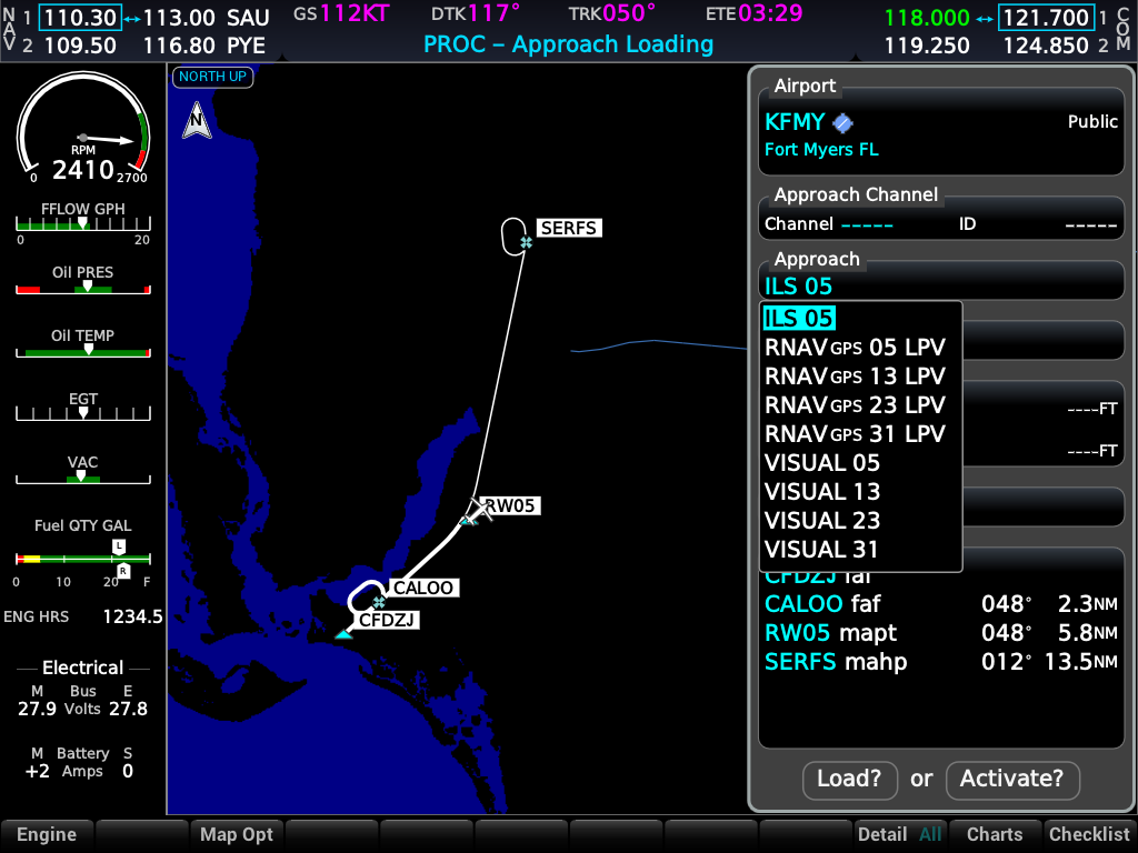
Approach course preview on the map with transition and runway selection.
Published hold procedures with entry and timing preview on the map.
NRST page listing nearby airports with bearing, distance, and approach availability.
Full-screen traffic scope on the MFD with ADS-B symbology and range control.
FAA obstacle symbols from the Daily Digital Obstacle File — white, yellow, and red hazard bands.
Full NXi map symbology for airports, VORs, NDBs, intersections, and airspace boundaries.
Precipitation overlay from X-Plane's ADS-B / FIS-B datalink — same path as Connext or ForeFlight.
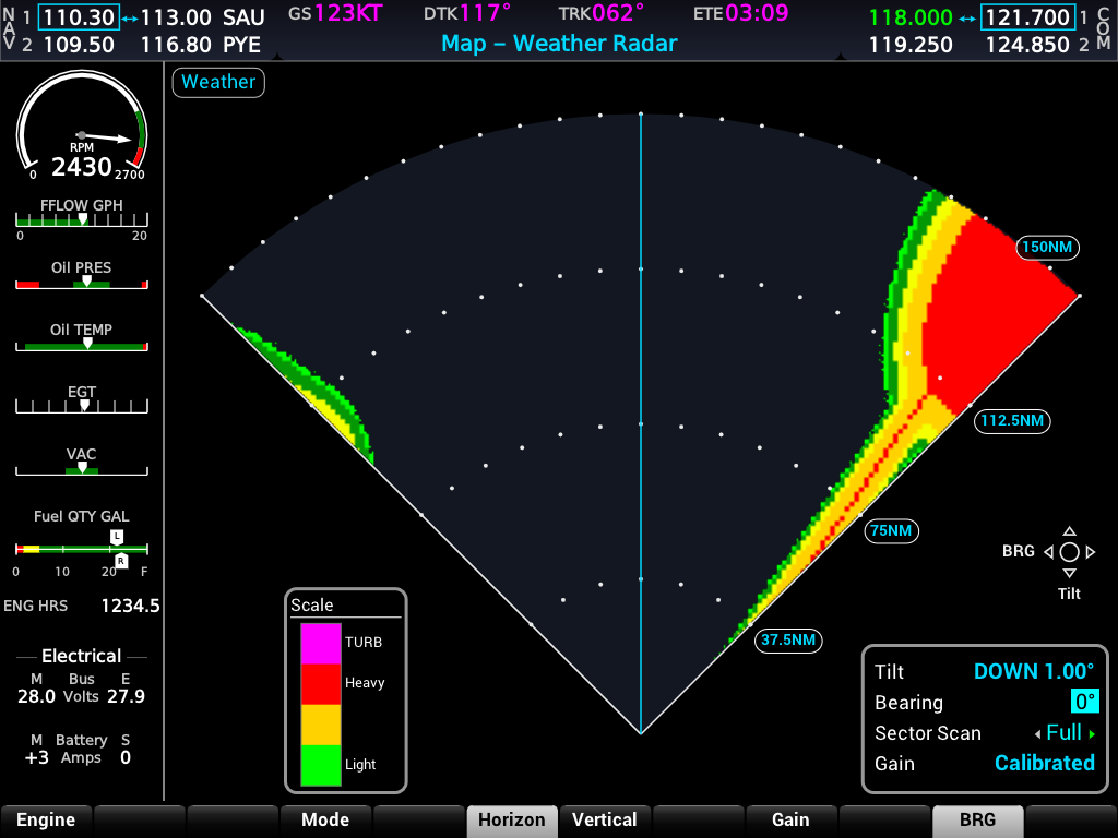
Onboard weather radar display when the aircraft is equipped — separate from the datalink overlay.
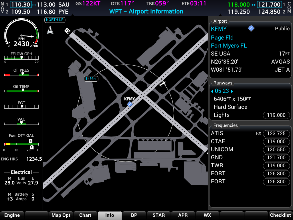
Airport and waypoint detail pages — runways, frequencies, and weather sub-pages.
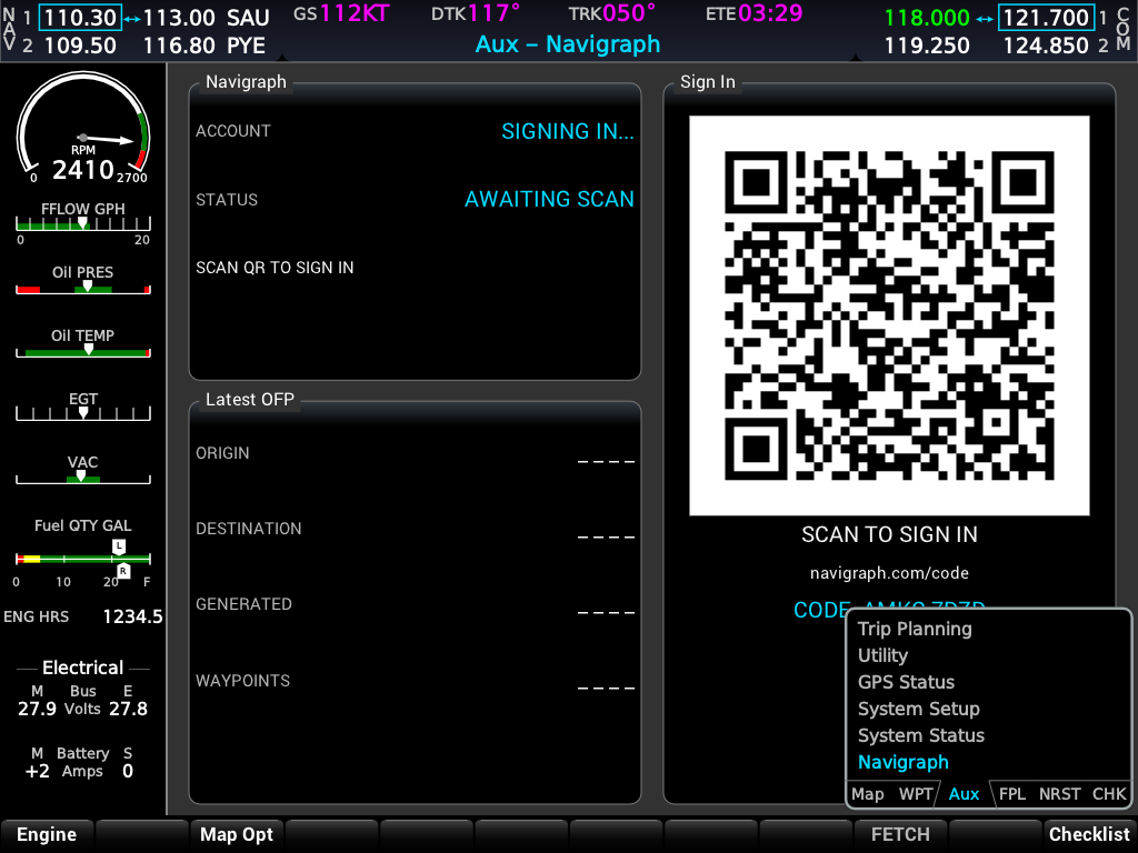
AUX → SIMBRIEF signs in via Navigraph and fetches your latest operational flight plan.
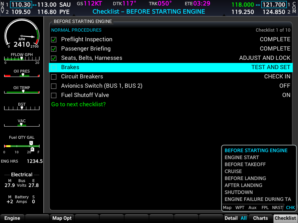
MFD Checklist page group with groups, items, and ENT/CLR check-off — from drop-in .checklist files.
Airport chart view on the WPT page when signed in to Navigraph (requires live sim session).
Every bezel key, softkey, and knob bindable — stock G1000 commands and xplane_avionics/*.
Installers include the X-Plane plugin and standalone shell for Windows, macOS, and Linux.
Download for your OSDetecting your OS…
Free for noncommercial use only. Personal sim flying, freeware aircraft, and training are covered under the PolyForm Noncommercial License. Payware aircraft, commercial distribution, or any for-profit use requires a commercial license.